"When dawn spreads its paintbrush on the plain, spilling purple... ," Sons of the Pioneers theme for TV show "Wagon Train." Dawn on the mythic Santa Fe Trail, New Mexico, looking toward Raton from Cimarron. -- Clarkphoto. A curmudgeon artist's musings melding metaphors and journalism, for readers in more than 150 countries.
Showing posts with label hiking. Show all posts

Monday, June 30, 2014

Favorite Oklahoma places, even more remote

On the trail up Black Mesa, about a mile and a half into the hike
You gotta want to go there.  It's not a "day-trip." More like two, or three. It's as far from Oklahoma City as you can get and be in Oklahoma. It won't be quick. It won't be easy. The drive can be mind-numbing before rewarding in the last few miles on SH 525 west of Boise City. The hike will take most of the day.
Black Mesa, Oklahoma's highest point at the tip of the panhandle, has got to be one of my top two favorite places in the state, along with Monument Hill.
It tells you a lot about me that I like remote places...so remote even cell phones don't work, thank God. So remote you can see a long way, have time to think, listen, smell, imagine, talk to your yourself and hear God answer.
Two years have passed since I made the 361-mile drive and the eight-mile hike, and a year since we went back for a night at Black Mesa Bed and Breakfast, where they hold hands and say grace before breakfast. 
It's not just Black Mesa of course, but the whole area, actually in the Mountain time zone. 
Black Mesa from the front porch of Black Mesa Bed and Breakfast
You can walk across the dry Cimarron, cruise though the almost ghost town of Kenton, cross a bridge into New Mexico and find 17 miles of unpaved state highway leading west, or turn north on dirt roads to dinosaur tracks and the three state marker where Oklahoma, Colorado and New Mexico meet. There's more, still to be discovered including Indian petroglyphs and ruts of the Santa Fe trail Cimarron cutoff. That's another trip.
Black Mesa sunset, 9 by 12, painted on the porch of the bed and breakfast.
The hike is eight miles, and when you get to the top, sign the register in the ammo box, lean against the granite monument erected by the Tulsa Tribune, marking distances to the other states, and telling stories. You can see forever.
But mostly you can breathe, really see the stars, and be free.
Here are the links to articles and photos I wrote two years ago on this blog:
(My other favorite places, with no ranking of preference, coming soon, in shorter articles,  scattered around the state. included will be three others in the northwest area--the so called Washita "battlefield," the Cimarron river cliffs at Freedom, Fort Reno and its cemetery at El Reno.)

Sunday, January 5, 2014

Ancient Oklahoma forest

Did you know that Oklahoma has a primitive forest? I didn't, until I read friend and blogging adventurer Alan Bate's New Year Day adventure in this crosstimber preserve. Alan lives in Tulsa, works in oil and gas, is a geocacher, photographer, and great husband and Dad. 
Read Yogi's Den's story of the Keystone Ancient Forest. It's now on my must go see list.

Wednesday, March 21, 2012

To the top of Oklahoma, and back

A hike to the highest point in Oklahoma, on top of Black Mesa at the tip of the panhandle in Cimarron County, is an adventure in endurance. It's more than an eight-mile round trip, and you better bring water and layered clothing, and a hat in warm or even spring weather, which is what I did...I wouldn't want to take it in August. Chilly when I started, I worked up a sweat climbing, and then needed my windbreaker again. Most of the trip is on level ground, but it's still at 4,000 feet or more, which is less oxygen than we flatlanders are used to, "downstate," as the Panhandle people refer to us.
   The first two miles are marked by benches and skirt the base of the sandstone mesa capped by a 10-million-year-old lava flow--hence the name Black Mesa. By the way, mesa is a Spanish word for "Table," inherited by us after 400 plus years from the Coronado and the Conquistatores, for table-like mountain.
  The immensity of the sky, and the quiet, the landscape captivates.
Here's the trailhead and mile one and two benches, all before you head up. It's also a Nature Preserve with more than 30 unique species there, and including Big horn sheep, mule deer,  and more. I saw only deer and coyote scat and meadowlarks and ravens.

This is where you turn toward the climbing at last. Ahead, the mesa towers about 1,000 feet above you.

After you start climbing, you reach the third mile bench, overlooking the edge, about 1/2 the way up. Above you, it looks daunting.
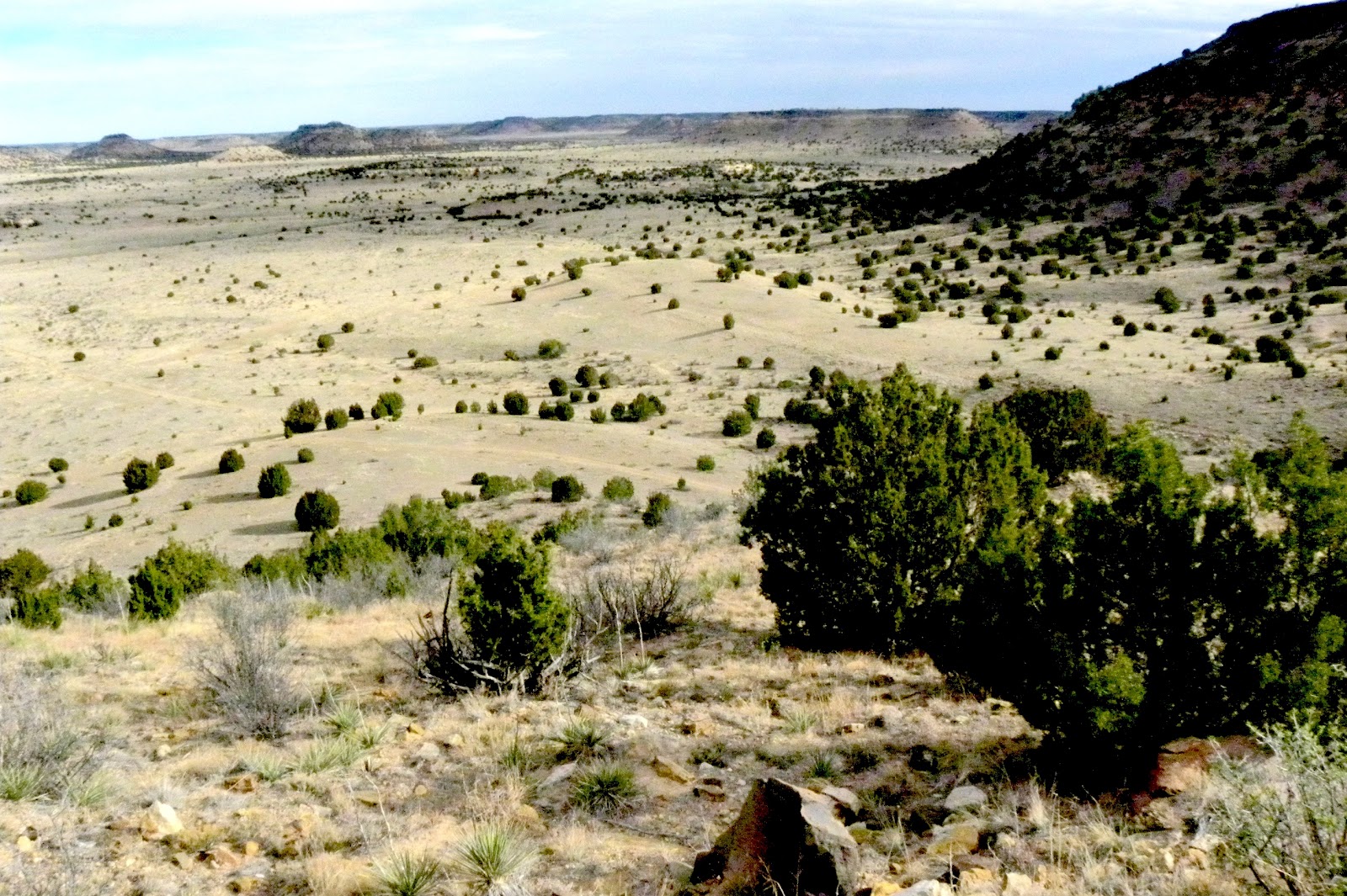
Behind you, you can see where you've been, including the trail you took to get here from bench two.

You stop to get your breath, and drink water. It get steeper. You notice the eroded sandstone that makes walking tricky and the lava at the rim, that vies the mesa its name.

 Ahead is the rim, and then the last leg to the top.

Once on top, it's level going for another distance. Finally you can see  the granite marker ahead, and then a sign.


Then you get to the marker, the highest point in Oklahoma. You sit down on a bench, thanks to a Boy Scout group, and look and wonder at the end of the Great Plains and beginning of the mountain West.

Next chapter, on the top of Oklahoma.